
Choose another river
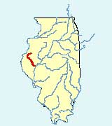
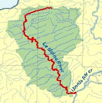
La Moine River
©Illinois State Water Survey
Description: The La Moine River, a tributary of the Illinois River, is located in western Illinois. It flows approximately 124 miles over a very irregular course that earned it its original name of Crooked Creek. Its major tributaries include Camp Creek and La Harpe Creek. The La Moine River flows south through seven counties and joins the Illinois River at the junction of Cass, Schuyler, and Brown counties.
The La Moine River area is home to two state parks and a conservation area — Argyle Lake State Park, Weinberg-King State Park, and Anderson Lake Conservation area.